Augel is a construction service provider for work in highly sensitive industrial plants and the energy sector. The company’s focus is always on state-of-the-art technical equipment. In search of a reliable solution for efficient surveying, Augel chose MOST Robotics as its partner. The result was not only a noticeable simplification of existing processes. The solution even allowed the company to make a valuable contribution to reconstruction after the floods in the Ahrtal.
From the company headquarters in the Eifel region, Augel realizes more than 150 construction sites throughout Germany every year. There is no question that this leads to a high degree of complexity. However, not only the coordination, but also the work itself is time-consuming. Surveying in particular is a time-consuming and critical process. Errors are fatal in most cases. To ensure goal-oriented, efficient and error-free work, Augel decided to look for solutions to simplify this work step with the help of digitization.
The decision was made to use drones to simplify the previously time-consuming land surveying process. Normal surveying using a total station is not always possible, or is associated with a significantly increased effort. Aerial surveying is a game changer, especially for customers in highly sensitive, critical facilities such as the energy sector or the petrochemical and manufacturing industries.

Analysis of the offer on the market
The requirements were clear: „We wanted a future-proof system that we could use for years to come and expand or upgrade as needed – regardless of whether it was a drone or a payload,“ says Florian Reuschenbach, surveying expert at Augel. In a comprehensive evaluation process, the construction services provider gained a comprehensive picture of market-leading solutions and chose MOST Robotics as its partner based on the scope of performance and functionality as well as the attractive price-performance ratio.
The specialist for drone systems from Wulften in Lower Saxony has meanwhile made a name for itself as a provider in this field despite its fairly young company history. With MOST’s customized drone solutions for surveying, customers can effortlessly and efficiently survey even hard-to-reach and large areas. This creates a 3D map accurate to the centimeter, which noticeably simplifies the planning of construction projects.
The best solution for the specific customer requirements
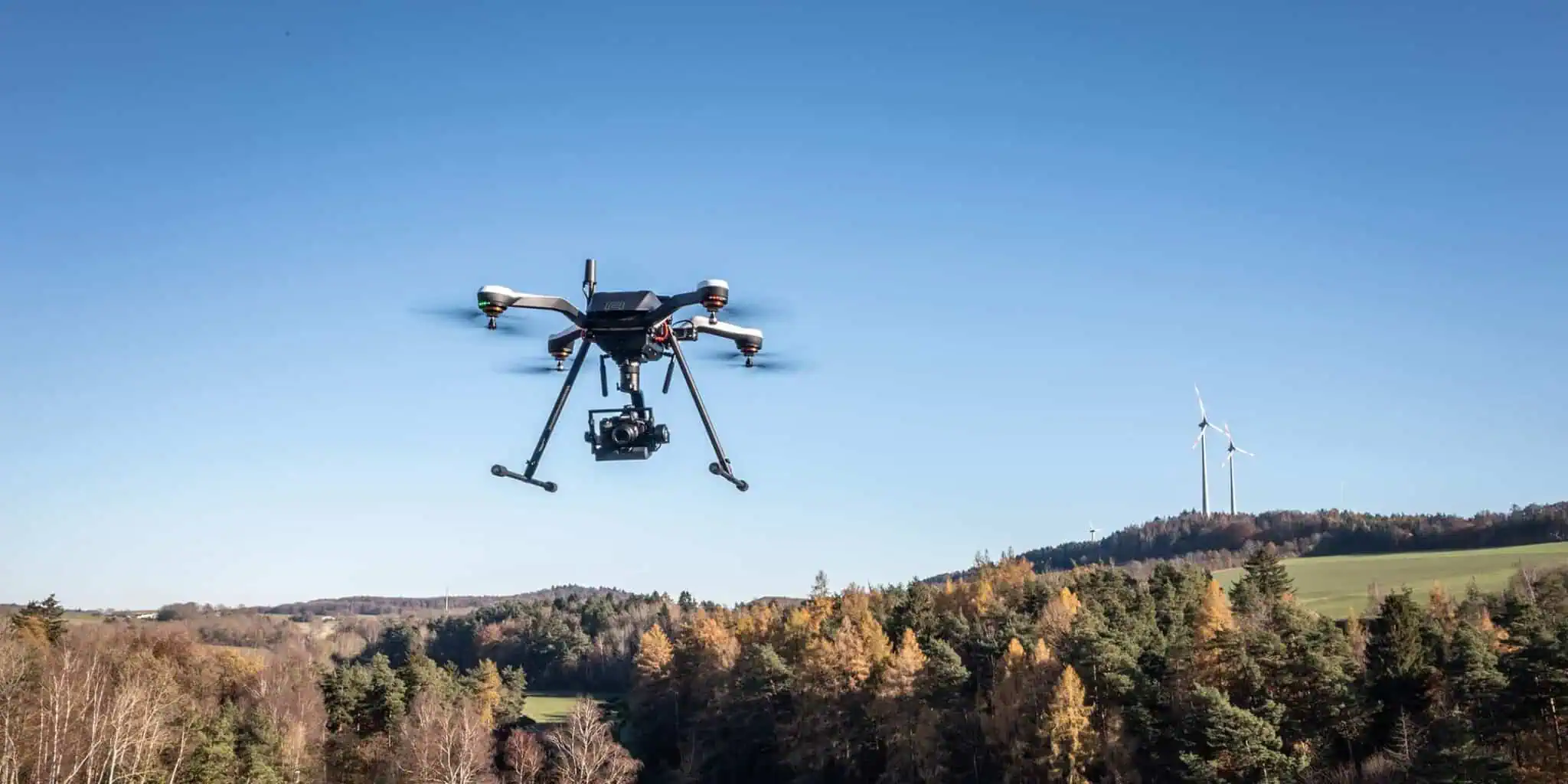
The express wish was to have a system manufactured in Europe as a basis. The reason for this was the sensitive data protection situation caused by critical infrastructure. DJI was therefore ruled out as a system. „We looked for a long time for a reliable drone platform for surveying that flies in wind and weather, but also supports as many payloads as possible.“ The choice fell on the ZOE, which, with a flight time of up to 45 minutes and the ability to carry up to 5 kilograms of payload, has the ideal prerequisites for the application area. Thanks to a modular design, components and assemblies can be easily and cost-effectively exchanged and expanded. The required flexibility and expandability were thus given.
The payload chosen was a Sony A7R IV with 35 mm lens and 61 megapixels, mounted on a Gremsy T3 gimbal. Thanks to the quick-release fastener, payloads such as thermal imaging cameras or LiDAR scanners can be exchanged in no time at all. This opens up a wide range of new application possibilities. In addition, this unique selling point enables Augel to differentiate itself from other competitors.
At the core of the drone is the EMLID RTK system, which enables centimeter-precise positioning of the drone, as well as the location of the individual images. This was combined with the native MOST mapping module, which provides automatic geotagging of the images and prevents manual errors in post-processing. To ensure a constant flight altitude in relation to the ground, Augel opted for Terrain Follow Lidar. This lets the drone climb and descend automatically. Collisions on rising terrain are thus prevented. This resulted in the ideal solution for the construction service provider’s requirements.


Comprehensive analysis as a basis
Before this was realized, the MOST Robotics team collected customer feedback during the analysis phase, recorded the requirements and wishes of the operators, and also spoke with the company’s internal employees. Subsequently, those involved in the project evaluated the results and, together with those responsible at Augel, found the best solution. This was one of the reasons why they convinced the customer. „The team from MOST Robotics made a competent impression from the first contact, right through to the purchase of our drone. As before, they take time for queries. It is really fun to work with them,“ says Florian Reuschenbach.
Unexpected purpose
Today, with the help of the multicopter, Augel can efficiently measure large and/or difficult-to-access areas from the air within a very short time, without contact and with high precision in three dimensions, accurate to the centimeter. At the beginning, no one could have imagined how relevant this would become, especially in the company’s own environment. After all, Augel is located directly in the area of the Ahr River, which became sadly famous due to the flood disaster in 2021. Thanks to the complete solution based on the ZOE X8, the company was able to actively support the reconstruction planning with orthophotos and point clouds in the months that followed. The data is used for hydraulic calculations, predictions of future flood events and analysis of the flood area.
The analysis is particularly important in the case of the flood on the Ahr River, as it reveals bottlenecks and terrain features that would cause a backwater. This not only helps to repair the damage promptly, but also to prevent future flooding.
The customer is pleased and looks forward to future challenges. „We are excited to see how the market for surveying will change in the coming years due to aerial surveying and what other exciting fields of activity will come our way as a result,“ says Reuschenbach. The complete solution from MOST Robotics gives them the necessary future security for a wide range of applications.